Your Vision Above.
Professional drone services for inspections, mapping, and more.
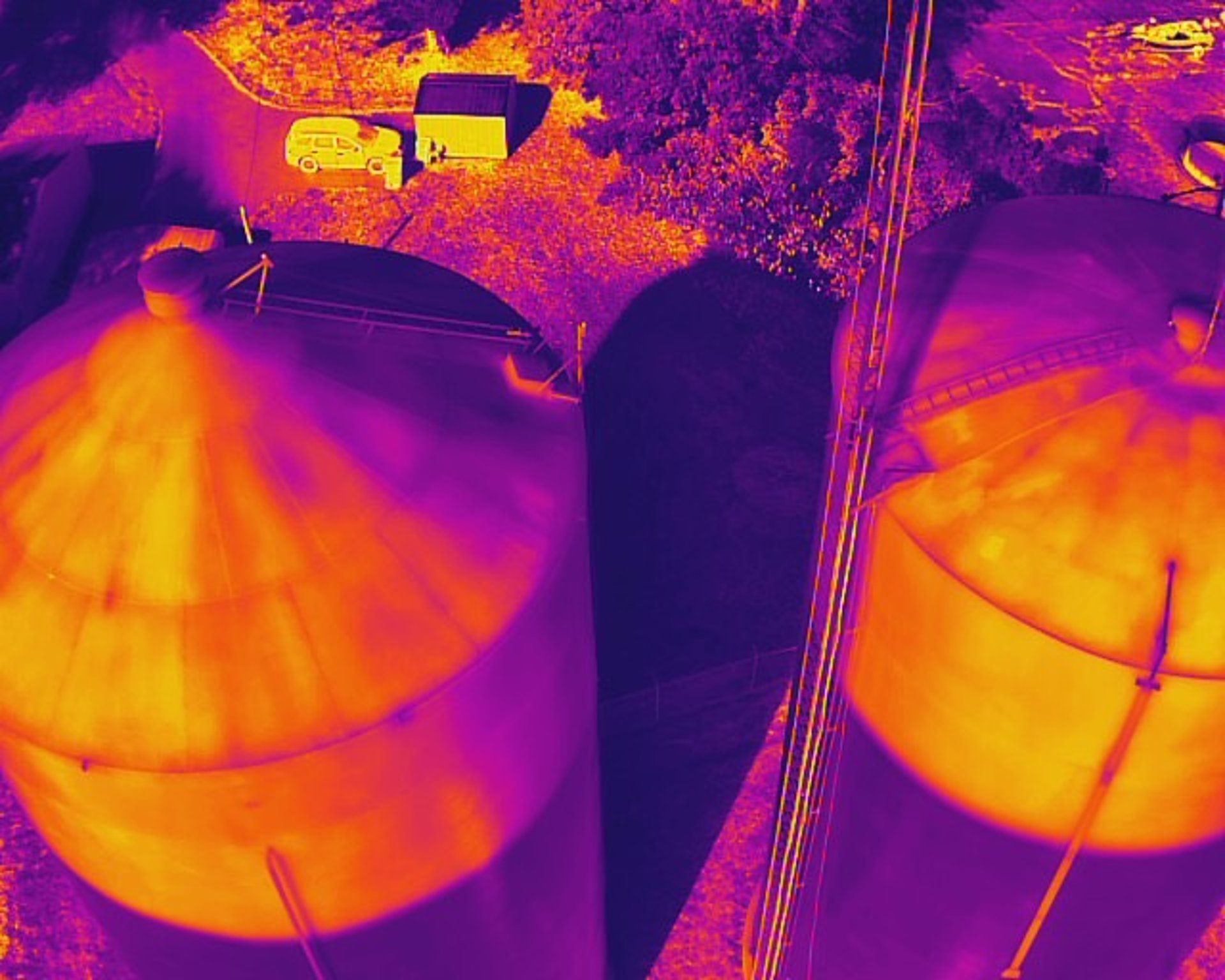
Aerial Inspections
Power
Roof
Crop
Hay
Pasture
Wildlife Management
Elevation Maps
Drainage Plots
Photograph Events or Places
Make stunning video presentation
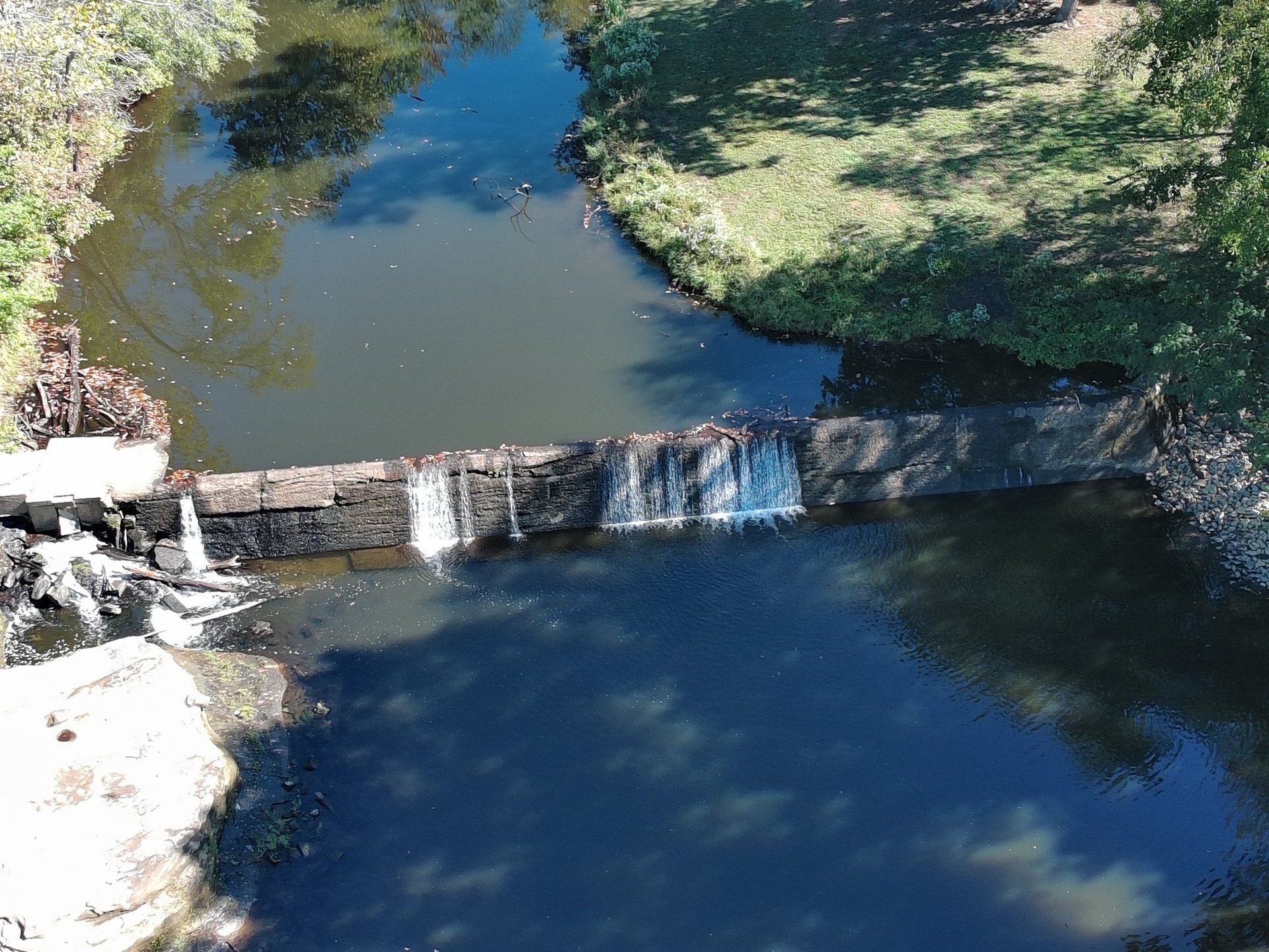
Aerial Mapping
Stunning visuals from above.
Vibration Analysis/Electric Motor Repair
2nd Opinion on Vibration Data
Collected data Analysis and Reporting
AC/DC Electrical Motor Repair
Consulting on Balancing and Alignments
About PredicTech, LLC
Predictech, LLC is a professional drone service based in Dawson Springs, Kentucky, specializing in thermography inspections, aerial mapping, crop management, and more.
"
Drone Services
Expert drone services for surveying, mapping, and aerial imagery in Kentucky.


Aerial Mapping
Employing sophisticated drone technology for accurate 2D and 3D mapping services.
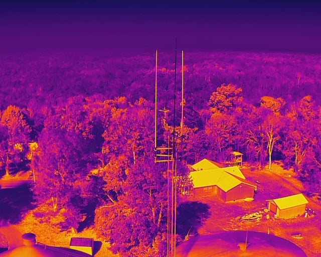
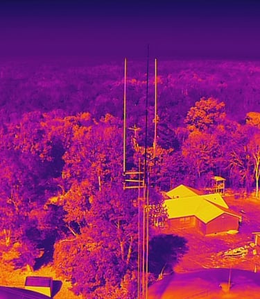
Infrared evaluations and analysis based on routes or just a single survey
Expert infrared assessments for roofing, electrical systems, structural evaluations, and agricultural crop/grass analysis
Our Location
Located in Dawson Springs, Kentucky, we provide expert drone services for various applications including inspections, mapping, and photography.
Stay Connected with Us
Get updates on our drone services